Difference between revisions of "Sgùrr Mòr"
From Wikishire
(Created page with '{{Infobox hill |name=Sgurr Mòr |county=Cromartyshire |picture=Sgurr Mor - geograph.org.uk - 49654.jpg |picture caption = |height=3,642 feet |range=Fannichs |os grid ref=NH20371…') |
m |
||
| Line 3: | Line 3: | ||
|county=Cromartyshire | |county=Cromartyshire | ||
|picture=Sgurr Mor - geograph.org.uk - 49654.jpg | |picture=Sgurr Mor - geograph.org.uk - 49654.jpg | ||
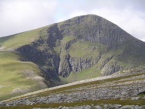
| − | |picture caption = | + | |picture caption=Sgurr Mòr |
|height=3,642 feet | |height=3,642 feet | ||
|range=Fannichs | |range=Fannichs | ||
Revision as of 10:40, 15 September 2011
| Sgurr Mòr | |||
| Cromartyshire | |||
|---|---|---|---|
 Sgurr Mòr | |||
| Range: | Fannichs | ||
| Summit: | 3,642 feet NH203718 | ||
Sgurr Mòr (Gaelic for “Big Peak”) is the highest mountain of Cromartyshire, and the highest of the nine Munros in the range known as the Fannichs.
The Fannicks spread between Loch Fannich and the A835 Ullapool road, which is a remote area, barely inhabited. Notwithstanding their grand height, these nine Munroes, usually climbed in groups or occasionally in a single hike, are mostly gentle sloped and fairly accessible from either of the loch or the road. If approached from Loch Fannich, a bicycle or permission to drive on the private road would be helpful.