Difference between revisions of "Hill of Stake"
From Wikishire
m |
|||
| (One intermediate revision by the same user not shown) | |||
| Line 7: | Line 7: | ||
|height=1,713 feet | |height=1,713 feet | ||
|os grid ref=NS273630 | |os grid ref=NS273630 | ||
| + | |latitude= 55.8292 | ||
| + | |longitude=-4.7588 | ||
}} | }} | ||
| − | '''Hill of Stake''' is a hill on the boundary between [[Ayrshire]] and [[Renfrewshire]]. It is the [[county top]] of Renfrewshire, its summit reaching 1,713 | + | '''Hill of Stake''' is a hill on the boundary between [[Ayrshire]] and [[Renfrewshire]]. It is the [[county top]] of Renfrewshire, its summit reaching 1,713 feet above sea level. |
The hill is within the Clyde Muirshiel Regional Park, and is the highest point of the park also. | The hill is within the Clyde Muirshiel Regional Park, and is the highest point of the park also. | ||
| Line 14: | Line 16: | ||
Two notable subsidiary summits barely short of the main summit are: | Two notable subsidiary summits barely short of the main summit are: | ||
| − | *'''East Girt Hill''' (1,673 feet, to the | + | *'''East Girt Hill''' (1,673 feet, to the south-east) |
| − | *'''West Girt Hill''' (to the | + | *'''West Girt Hill''' (to the south-west, wholly in Ayrshire) |
==Outside links== | ==Outside links== | ||
Latest revision as of 09:44, 22 March 2018
| Hill of Stake | |
| Renfrewshire, Ayrshire | |
|---|---|
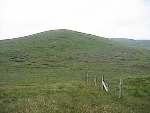
 Hill of Stake - geograph.org.uk - 30223.jpg | |
| Summit: | 1,713 feet NS273630 55°49’45"N, 4°45’32"W |
Hill of Stake is a hill on the boundary between Ayrshire and Renfrewshire. It is the county top of Renfrewshire, its summit reaching 1,713 feet above sea level.
The hill is within the Clyde Muirshiel Regional Park, and is the highest point of the park also.
Two notable subsidiary summits barely short of the main summit are:
- East Girt Hill (1,673 feet, to the south-east)
- West Girt Hill (to the south-west, wholly in Ayrshire)