Difference between revisions of "Y Garn (Plynlimon)"
From Wikishire
(Created page with '{{Infobox hill |name=Y Garn |county=Cardiganshire |range=Cambrian Mountains |picture=View towards Y Garn - geograph.org.uk - 1495605.jpg |picture caption=Y Garn from the Nant-y-m…') |
|||
| (2 intermediate revisions by one other user not shown) | |||
| Line 7: | Line 7: | ||
|height=2,244 feet | |height=2,244 feet | ||
|os grid ref=SN789869 | |os grid ref=SN789869 | ||
| + | |latitude=52.466568 | ||
| + | |longitude=-3.784047 | ||
}} | }} | ||
'''Y Garn''' is a subsidiary summit of [[Plynlimon]] and the fourth highest peak on the Plynlimon massif, a part of the [[Cambrian Mountains]]. It is in [[Cardiganshire]], west of the border with [[Montgomeryshire]]. | '''Y Garn''' is a subsidiary summit of [[Plynlimon]] and the fourth highest peak on the Plynlimon massif, a part of the [[Cambrian Mountains]]. It is in [[Cardiganshire]], west of the border with [[Montgomeryshire]]. | ||
| Line 12: | Line 14: | ||
The summit is marked by a large shelter cairn, hollowed out from an ancient burial cairn. The views are widespread over the Cambrian range, including [[Rhos Fawr]], [[Drygarn Fawr]], [[Pen y Garn]] to the south and [[Aran Fawddwy]], [[Glasgwm]], [[Tarrenhendre]] and [[Tarren y Gesail]] to the north. | The summit is marked by a large shelter cairn, hollowed out from an ancient burial cairn. The views are widespread over the Cambrian range, including [[Rhos Fawr]], [[Drygarn Fawr]], [[Pen y Garn]] to the south and [[Aran Fawddwy]], [[Glasgwm]], [[Tarrenhendre]] and [[Tarren y Gesail]] to the north. | ||
| − | The Nant-y-moch Reservoir can also be seen to the north, with the smaller summits of '''Drosgol''' ( | + | The Nant-y-moch Reservoir can also be seen to the north, with the smaller summits of '''Drosgol''' (1,805 feet) and '''Banc Llechwedd-mawr''' (1,837 feet).<ref>Nuttall, John & Anne (1999). The Mountains of England & Wales - Volume 1: Wales (2nd edition ed.). Milnthorpe, Westmorland: Cicerone. ISBN 1-85284-304-7.</ref> |
==Outside links== | ==Outside links== | ||
Latest revision as of 10:15, 14 September 2018
| Y Garn | |||
| Cardiganshire | |||
|---|---|---|---|
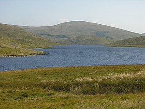
 Y Garn from the Nant-y-moch Reservoir | |||
| Range: | Cambrian Mountains | ||
| Summit: | 2,244 feet SN789869 52°27’60"N, 3°47’3"W | ||
Y Garn is a subsidiary summit of Plynlimon and the fourth highest peak on the Plynlimon massif, a part of the Cambrian Mountains. It is in Cardiganshire, west of the border with Montgomeryshire.
The summit is marked by a large shelter cairn, hollowed out from an ancient burial cairn. The views are widespread over the Cambrian range, including Rhos Fawr, Drygarn Fawr, Pen y Garn to the south and Aran Fawddwy, Glasgwm, Tarrenhendre and Tarren y Gesail to the north.
The Nant-y-moch Reservoir can also be seen to the north, with the smaller summits of Drosgol (1,805 feet) and Banc Llechwedd-mawr (1,837 feet).[1]
Outside links
References
- ↑ Nuttall, John & Anne (1999). The Mountains of England & Wales - Volume 1: Wales (2nd edition ed.). Milnthorpe, Westmorland: Cicerone. ISBN 1-85284-304-7.