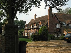
Ashton, Hampshire
From Wikishire
Revision as of 20:38, 4 September 2022 by RB (Talk | contribs) (Created page with "{{Infobox town |name=Ashton |county=Hampshire |picture=Ashton House, Ashton - geograph.org.uk - 56404.jpg |picture caption=Ashton House |os grid ref=SU556190 |latitude=50.9684...")
| Ashton | |
| Hampshire | |
|---|---|
 Ashton House | |
| Location | |
| Grid reference: | SU556190 |
| Location: | 50°58’6"N, 1°12’32"W |
| Data | |
| Post town: | Southampton |
| Postcode: | SO32 |
| Dialling code: | 01489 |
| Local Government | |
| Council: | Winchester |
| Parliamentary constituency: |
Meon Valley |
Ashton is a village in Hampshire. It consists of mainly substantial properties and is situated just inside the boundary for the South Downs National Park.
The local pub is the White Horse.
Outside links
| ("Wikimedia Commons" has material about Ashton, Hampshire) |