File:British Virgin Islands location detail.svg
From Wikishire

Size of this preview: 800 × 433 pixels. Other resolution: 320 × 173 pixels.
Original file (SVG file, nominally 3,572 × 1,934 pixels, file size: 3.36 MB)
Summary
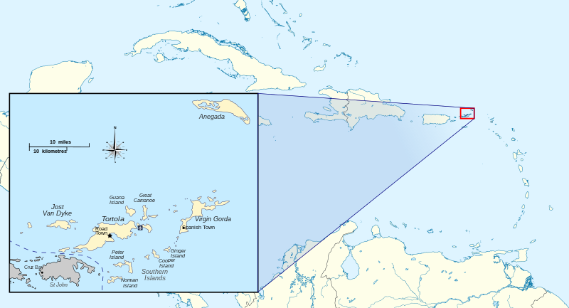
| Description | Map and location of the British Virgin Islands | ||
| Date | |||
| Source | |||
| Author | Hogweard | ||
| Permission (Reusing this file) |
|
File history
Click on a date/time to view the file as it appeared at that time.
| Date/Time | Thumbnail | Dimensions | User | Comment | |
|---|---|---|---|---|---|
| current | 19:05, 4 April 2020 | | 3,572 × 1,934 (3.36 MB) | Hogweard | {{Information |description=Map and location of the British Virgin Islands |date=2020-04-04 |source= *{{f|British Virgin Islands - Caribbean.svg}} *{{f|Anegada BVI.svg}} |author={{u|Hogweard}} |permission={{PD-self}} |other versions= }} Category:SVG maps of the British Virgin Islands Category:Locator maps of the British Virgin Islands |
File usage
The following file is a duplicate of this file (more details):
- File:British Virgin Islands location detail.svg from a shared repository
The following page links to this file: