File:Hartington Signal Box and the Tissington Trail. - geograph.org.uk - 10973.jpg
From Wikishire
No higher resolution available.
Hartington_Signal_Box_and_the_Tissington_Trail._-_geograph.org.uk_-_10973.jpg (640 × 424 pixels, file size: 62 KB, MIME type: image/jpeg)
Summary
| Description |
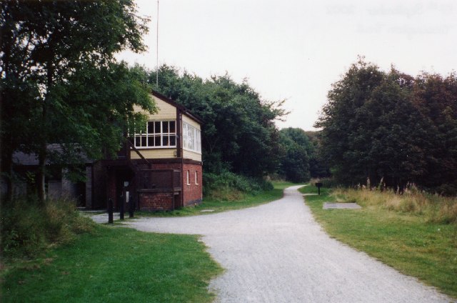
English: Hartington Signal Box and the Tissington Trail. Looking south. The route of the former Buxton to Ashbourne railway. Regular services ceased in 1954 and the line was closed in the 1960's. The Tissington Trail runs for 13 miles between Ashbourne and Parsley Hay and is popular with walkers and cyclists. The signal box has been renovated. |
| Date | |
| Source | From geograph.org.uk |
| Author | Janine Forbes |
| Attribution (required by the license) | Janine Forbes / Hartington Signal Box and the Tissington Trail. / |
| Object location | | View this and other nearby images on: OpenStreetMap |
|---|
_&language=en)
Licensing

|
This image was taken from the Geograph project collection. See this photograph's page on the Geograph website for the photographer's contact details. The copyright on this image is owned by Janine Forbes and is licensed for reuse under the Creative Commons Attribution-ShareAlike 2.0 license.
|
This file is licensed under the Creative Commons Attribution-Share Alike 2.0 Generic license.
Attribution: Janine Forbes
- You are free:
- to share – to copy, distribute and transmit the work
- to remix – to adapt the work
- Under the following conditions:
- attribution – You must give appropriate credit, provide a link to the license, and indicate if changes were made. You may do so in any reasonable manner, but not in any way that suggests the licensor endorses you or your use.
- share alike – If you remix, transform, or build upon the material, you must distribute your contributions under the same or compatible license as the original.
- Remove redundant categories and try to put this image in the most specific category/categories
- Remove this template
- The location categories are based on information from this geonames tool and this OpenStreetMap tool combined with a database. You can also have a look at this tool from mysociety.
- The topic category from Geograph was Railway (disused) (find similar images (disused) at Geograph)
File history
Click on a date/time to view the file as it appeared at that time.
| Date/Time | Thumbnail | Dimensions | User | Comment | |
|---|---|---|---|---|---|
| current | 03:11, 30 January 2010 | | 640 × 424 (62 KB) | GeographBot | == {{int:filedesc}} == {{Information |description={{en|1=Hartington Signal Box and the Tissington Trail. Looking south. The route of the former Buxton to Ashbourne railway. Regular services ceased in 1954 and the line was closed in the 1960's. The Tissing |
File usage
The following file is a duplicate of this file (more details):
- File:Hartington Signal Box and the Tissington Trail. - geograph.org.uk - 10973.jpg from a shared repository
The following page links to this file: