File:LONDON, MARYLEBONE by BARTLETT, F.A. and B.J. DAVIES.jpg
From Wikishire
Size of this preview: 505 × 600 pixels. Other resolution: 202 × 240 pixels.
Original file (1,684 × 2,000 pixels, file size: 1.39 MB, MIME type: image/jpeg)
Summary
| Description |
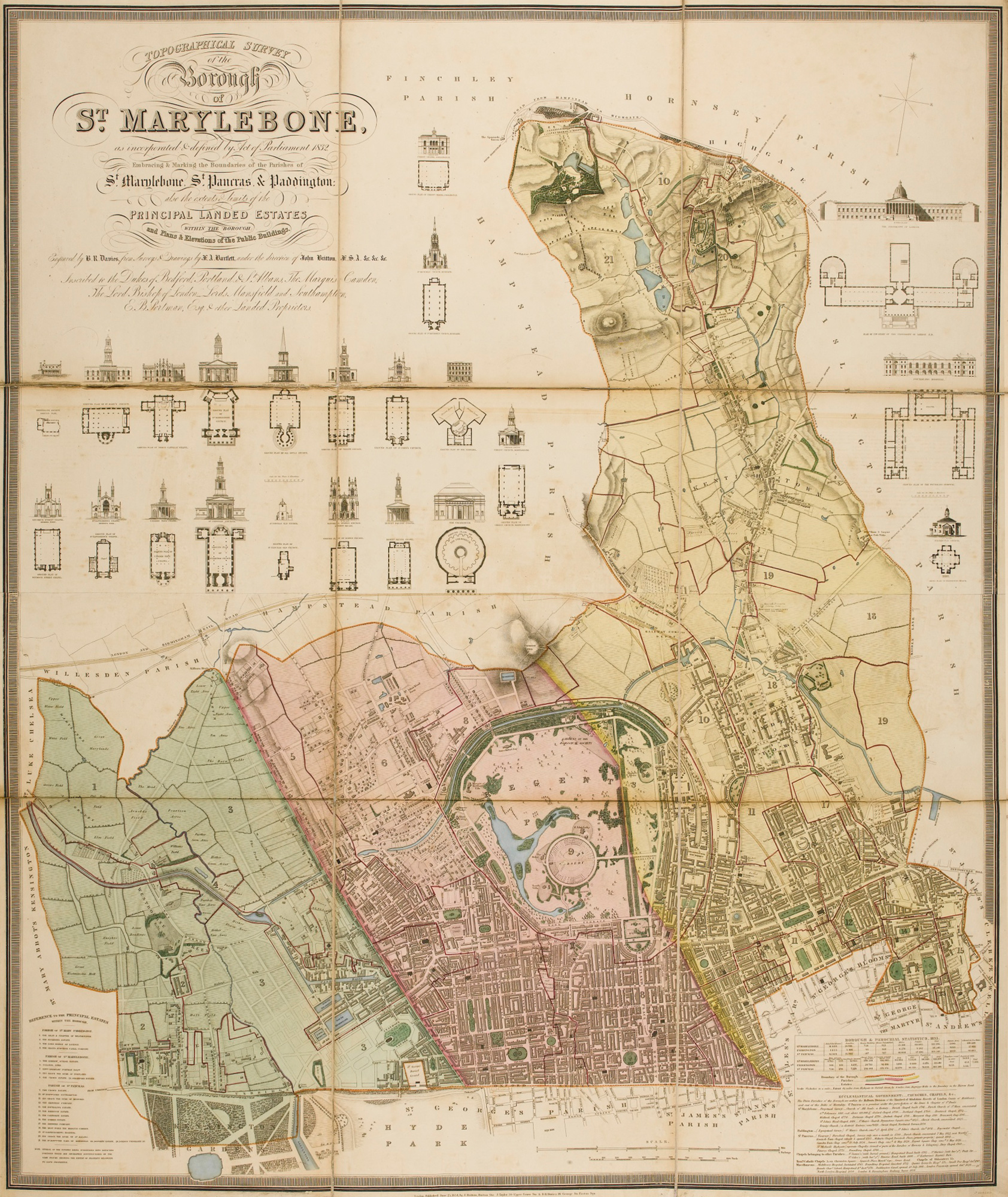
English: Topographical survey of the borough of St. Marylebone, as incorporated by Act of Parliament 1832, embracing and marking the boundaries of the parishes St. Marylebone, St. Pancras and Paddington. The plan was engraved by B.R. Davies, blank spaces filled with plans and elevations of 20 important buildings, 1145 x 950mm, dated 1834. |
| Date | |
| Source | http://www.sothebys.com/en/auctions/ecatalogue/2012/english-literature-history-l12408/lot.14.lotnum.html |
| Author | J. Britton, J. Taylor & B.R. Davies |
Licensing
|
This work is in the public domain in its country of origin and other countries and areas where the copyright term is the author's life plus 100 years or fewer. | |
| This file has been identified as being free of known restrictions under copyright law, including all related and neighboring rights. | |
File history
Click on a date/time to view the file as it appeared at that time.
| Date/Time | Thumbnail | Dimensions | User | Comment | |
|---|---|---|---|---|---|
| current | 00:16, 29 November 2017 | | 1,684 × 2,000 (1.39 MB) | Nagualdesign | Perspective correction. |
File usage
The following file is a duplicate of this file (more details):
- File:LONDON, MARYLEBONE by BARTLETT, F.A. and B.J. DAVIES.jpg from a shared repository
The following page links to this file: