File:Pont Dafydd - geograph.org.uk - 2735828.jpg
Summary
| Description |
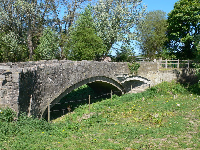
English: Pont Dafydd, CTYPE html PUBLIC "-//W3C//DTD XHTML 1.0 Strict//EN"
"http://www.w3.org/TR/xhtml1/DTD/xhtml1-strict.dtd"> <html xmlns="http://www.w3.org/1999/xhtml" xml:lang="en" id="geograph"> <head> <title>Pont Dafydd:: OS grid SJ0475 :: Geograph Britain and Ireland - photograph every grid square!</title> <meta http-equiv="Content-Type" content="text/html; charset=iso-8859-1" /> <meta name="description" content="Bridge on an old coaching road over the river Clwyd near St Asaph, built originally in 1630 by Bishop Dafydd. The original bridge was replaced in 1840 with a stronger bridge, which itself became obsolete when the river Clwyd was diverted." /> <meta name="ICBM" content="53.263618360974, -3.4350235530954"/> <meta name="DC.title" content="Geograph:: Pont Dafydd:: OS grid SJ0475"/> <link rel="stylesheet" type="text/css" title="Monitor" href="http://s1.geograph.org.uk/templates/basic/css/basic.v7747.css" media="screen" /> <link rel="shortcut icon" type="image/x-icon" href="http://s1.geograph.org.uk/favicon.ico"/> <link rel="alternate" type="application/vnd.google-earth.kml+xml" href="/photo/2735828.kml"/> <link rel="search" type="application/opensearchdescription+xml" title="Geograph Britain and Ireland search" href="/stuff/osd.xml" /> <script type="text/javascript" src="http://s1.geograph.org.uk/js/geograph.v7635.js"></script> </head> <body> <a title="Geograph home page" href="/">Geograph - photograph every grid square</a><a title="Grid Reference SJ0475 :: 13 images" href="/gridref/SJ0475">SJ0475</a> : Pont Dafyddnear to St Asaph, Denbighshire/Sir Ddinbych, Great Britain. |
| Date | |
| Source | From geograph.org.uk; transferred by User:Skinsmoke using geograph_org2commons. |
| Author | Eirian Evans |
| Permission (Reusing this file) |
Creative Commons Attribution Share-alike license 2.0 |
| Attribution (required by the license) | Eirian Evans / Pont Dafydd / |
| Camera location | | View this and other nearby images on: OpenStreetMap |
|---|
| Object location | | View this and other nearby images on: OpenStreetMap |
|---|
_region:GB-GBN_heading:315.00&language=en)
Licensing

|
This image was taken from the Geograph project collection. See this photograph's page on the Geograph website for the photographer's contact details. The copyright on this image is owned by Eirian Evans and is licensed for reuse under the Creative Commons Attribution-ShareAlike 2.0 license.
|
- You are free:
- to share – to copy, distribute and transmit the work
- to remix – to adapt the work
- Under the following conditions:
- attribution – You must give appropriate credit, provide a link to the license, and indicate if changes were made. You may do so in any reasonable manner, but not in any way that suggests the licensor endorses you or your use.
- share alike – If you remix, transform, or build upon the material, you must distribute your contributions under the same or compatible license as the original.
File history
Click on a date/time to view the file as it appeared at that time.
| Date/Time | Thumbnail | Dimensions | User | Comment | |
|---|---|---|---|---|---|
| current | 17:48, 10 April 2013 | | 640 × 480 (156 KB) | File Upload Bot (Magnus Manske) |
File usage
The following file is a duplicate of this file (more details):
- File:Pont Dafydd - geograph.org.uk - 2735828.jpg from a shared repository
The following page links to this file: