File:Thorney Street, Westminster, London SW1 - geograph.org.uk - 740624.jpg
From Wikishire

Size of this preview: 424 × 599 pixels. Other resolution: 170 × 240 pixels.
Original file (453 × 640 pixels, file size: 83 KB, MIME type: image/jpeg)
Summary
| Description |
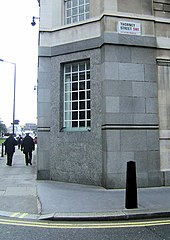
English: Thorney Street, Westminster, London SW1 Thorney or the Island of Thorns was an island by the River Thames formed by where the Tyburn Stream flowed into the Thames. It was on this island that King Cnut built his palace which later became the Palace of Westminster. Today this street name is the only reminder of this island. |
| Date | |
| Source | From geograph.org.uk |
| Author | Kevin Gordon |
| Attribution (required by the license) | Kevin Gordon / Thorney Street, Westminster, London SW1 / |
| Camera location | | View this and other nearby images on: OpenStreetMap |
|---|
_heading:90.00&language=en)
| Object location | | View this and other nearby images on: OpenStreetMap |
|---|
_heading:90.00&language=en)
Licensing

|
This image was taken from the Geograph project collection. See this photograph's page on the Geograph website for the photographer's contact details. The copyright on this image is owned by Kevin Gordon and is licensed for reuse under the Creative Commons Attribution-ShareAlike 2.0 license.
|
This file is licensed under the Creative Commons Attribution-Share Alike 2.0 Generic license.
Attribution: Kevin Gordon
- You are free:
- to share – to copy, distribute and transmit the work
- to remix – to adapt the work
- Under the following conditions:
- attribution – You must give appropriate credit, provide a link to the license, and indicate if changes were made. You may do so in any reasonable manner, but not in any way that suggests the licensor endorses you or your use.
- share alike – If you remix, transform, or build upon the material, you must distribute your contributions under the same or compatible license as the original.
File history
Click on a date/time to view the file as it appeared at that time.
| Date/Time | Thumbnail | Dimensions | User | Comment | |
|---|---|---|---|---|---|
| current | 13:00, 19 February 2011 | | 453 × 640 (83 KB) | GeographBot | == {{int:filedesc}} == {{Information |description={{en|1=Thorney Street, Westminster, London SW1 Thorney or the Island of Thorns was an island by the River Thames formed by where the Tyburn Stream flowed into the Thames. It was on this island that King Cn |
File usage
The following file is a duplicate of this file (more details):
- File:Thorney Street, Westminster, London SW1 - geograph.org.uk - 740624.jpg from a shared repository
The following page links to this file: