Great Stukeley
From Wikishire
Revision as of 19:21, 17 May 2012 by RB (Talk | contribs) (Created page with '{{Infobox town |name=Great Stukeley |county=Huntingdonshire |picture=St Bartholomew's church with neighbouring thatched cottage - geograph.org.uk - 460340.jpg |picture caption=St…')
| Great Stukeley | |
| Huntingdonshire | |
|---|---|
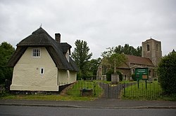
 St Bartholomew's, behind a cottage | |
| Location | |
| Grid reference: | TL219746 |
| Location: | 52°21’24"N, 0°12’37"W |
| Data | |
| Postcode: | PE28 |
| Local Government | |
| Council: | Huntingdonshire |
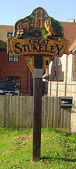
Great Stukeley is a village in Huntingdonshire. It and neighbouring Little Stukeley are collectively known as The Stukeleys.
The Stukeleys stand in the middle of the county, a little to the northwest of the county town, Huntingdon, along the local road out of Huntingdon towards Alconbury. Great Stukeley lies to the southeast of its smaller neighbour.
The parish church is St Bartholomew's.
RAF Alconbury stretches all along the northeast side of the road from Alconbury, the whole length of Little Stukeley to the edge of Great Stukeley.
This Huntingdonshire article is a stub: help to improve Wikishire by building it up.