File:Bridge over Afon Dewi Fawr River in Meidrim.jpg
From Wikishire

Size of this preview: 800 × 600 pixels. Other resolution: 320 × 240 pixels.
Original file (1,600 × 1,200 pixels, file size: 546 KB, MIME type: image/jpeg)
Summary
| Description |
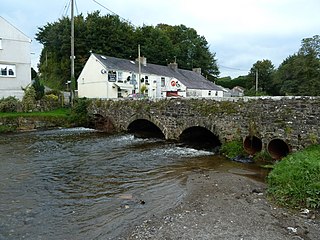
English: Bridge over the Afon Dewi Fawr river that runs through the centre of Meidrim with the Fountain Inn in the background. |
| Date | 22 October 2013 (original upload date) |
| Source | Geograph.org.uk |
| Author | Ruth Sharville |
| Attribution (required by the license) | Ruth Sharville / Bridge over the Afon Dewi Fawr, Meidrim / |
| Camera location | | View this and other nearby images on: OpenStreetMap |
|---|
_heading:337.00&language=en)
| Object location | | View this and other nearby images on: OpenStreetMap |
|---|
_heading:337.00&language=en)
Licensing

|
This image was taken from the Geograph project collection. See this photograph's page on the Geograph website for the photographer's contact details. The copyright on this image is owned by Ruth Sharville and is licensed for reuse under the Creative Commons Attribution-ShareAlike 2.0 license.
|
This file is licensed under the Creative Commons Attribution-Share Alike 2.0 Generic license.
Attribution: Ruth Sharville
- You are free:
- to share – to copy, distribute and transmit the work
- to remix – to adapt the work
- Under the following conditions:
- attribution – You must give appropriate credit, provide a link to the license, and indicate if changes were made. You may do so in any reasonable manner, but not in any way that suggests the licensor endorses you or your use.
- share alike – If you remix, transform, or build upon the material, you must distribute your contributions under the same or compatible license as the original.
Original upload log
Transferred from en.wikipedia to Commons by Stefan4 using CommonsHelper.
The original description page was here. All following user names refer to en.wikipedia.
- 2013-10-22 00:30 Brianclog 640×480× (98397 bytes) Bridge over the Afon Dewi Fawr river that runs through the centre of Meidrim with the Fountain Inn in the background.
File history
Click on a date/time to view the file as it appeared at that time.
| Date/Time | Thumbnail | Dimensions | User | Comment | |
|---|---|---|---|---|---|
| current | 18:50, 10 September 2017 | | 1,600 × 1,200 (546 KB) | Geograph Update Bot | Higher-resolution version from Geograph. |
File usage
The following file is a duplicate of this file (more details):
- File:Bridge over Afon Dewi Fawr River in Meidrim.jpg from a shared repository
The following page links to this file: