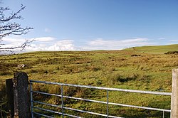
Bewaldeth
From Wikishire
| Bewaldeth | |
| Cumberland | |
|---|---|
 The site of Caer Mote Roman Fort | |
| Location | |
| Grid reference: | NY210347 |
| Location: | 54°42’6"N, 3°13’30"W |
| Data | |
| Post town: | Cockermouth |
| Postcode: | CA13 |
| Dialling code: | 017687 |
| Local Government | |
| Council: | Cumberland |
| Parliamentary constituency: |
Workington |
Bewaldeth is a little village in Cumberland, on the edge of the Lake District, with the meadows of the River Derwent to the south-west and the outlier hill of Binsey (1,467 feet) lomming over the village to the east, beyond which the Lake District Fells begin.
According to the 2001 census, Bewaldreth and the nearby hamlet Snittlegarth had together a population of just 40 and at the 2011 Census it was measured that the population was still less than 100, though by that time the villages were not separately enumerated
Along a lane south-east of the village is a hamlet named High Bewaldeth at 54°41’47"N, 3°12’17"W.
Outside links
| ("Wikimedia Commons" has material about Bewaldeth) |