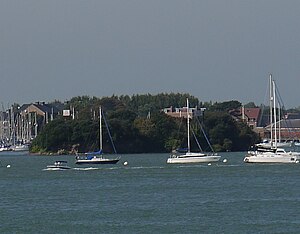
Burrow Island
Burrow Island (also known as Rat Island) is an uninhabited tidal island in Portsmouth Harbour, on the south coast of Hampshire.[1] At low tide a spit connects it with Priddy's Hard.[1]
It has been suggested that the name dates from the 17th century and is derived from being within the then borough of Portsmouth.[2]
Between 1678 and 1679, a fortification named Fort James was constructed on the island under the direction of Bernard de Gomme.[1] It took the form of a square tower 19 feet tall. [1] The fortification was apparently allowed to decay, and George Byng, 1st Viscount Torrington commented on its poor condition in a letter written in either 1707 or 1708.[3] It appears that a rebuilding to a new design was proposed on 1750 but this never took place.[1] What were by then the ruins of the fort were partially demolished 1827 and nothing now remains above ground level.[1]
It has been claimed that King Stephen built a fortification on the island but this is unlikely to have been the case.[4]
Burrow Island is owned by the Ministry of Defence and public access is not permitted.[5]
Burrow Island is one of 43 tidal islands which can be walked to from the mainland of Great Britain.[5]
References
- ↑ 1.0 1.1 1.2 1.3 1.4 1.5 Williams, G.H (1979). The Western Defences of Portsmouth Harbour 1400-1800. Portsmouth City Council. pp. 21–22. ISBN 0-901559-37-7.
- ↑ Philip Eley (7 September 2010). "The Place Names of Gosport by Philip Eley". Hampshire County Counci. http://www3.hants.gov.uk/gdc/gosport-dc-local-studies/local-history-online/place-names-of-gosport.htm. Retrieved 12 January 2011.
- ↑ Williams, G.H (1979). The Western Defences of Portsmouth Harbour 1400-1800. Portsmouth City Council. p. 19. ISBN 0-901559-37-7.
- ↑ Williams, G.H (1979). The Western Defences of Portsmouth Harbour 1400-1800. Portsmouth City Council. p. 7. ISBN 0-901559-37-7.
- ↑ 5.0 5.1 No Boat Required – Exploring Tidal Islands. Peter Caton 2011. Troubador. ISBN 978-1848767-010
Coordinates: 50°48′12″N 1°07′16″W / 50.8033°N 1.121°W
