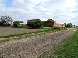
Carrington, Lincolnshire
From Wikishire
| Carrington | |
| Lincolnshire | |
|---|---|
 Chapel Farm, Carrington | |
| Location | |
| Grid reference: | TF310553 |
| Location: | 53°4’46"N, 0°2’41"W |
| Data | |
| Postcode: | PE22 |
| Local Government | |
Carrington is a hamlet in Holland in Lincolnshire, which is stretched along a single fenland road, the B1183 north of Boston.
The place has a small church, St Paul, and industry in the form of Rundle's Mill.
Pictures
| ("Wikimedia Commons" has material about Carrington, Lincolnshire) |

