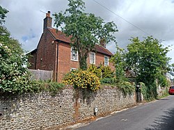
East Lavant
From Wikishire
| East Lavant | |
| Sussex | |
|---|---|
 East Lavant | |
| Location | |
| Grid reference: | SU862084 |
| Location: | 50°52’8"N, 0°46’32"W |
| Data | |
| Population: | 1,656 (2011) |
| Post town: | Chichester |
| Postcode: | PO18 |
| Local Government | |
| Council: | Chichester |
| Parliamentary constituency: |
Chichester |
East Lavant is a small villlage in the very west of Sussex. To the west is the larger village of Mid Lavant, and west of that a hamlet, West Lavant.
The village is listed in the Domesday Book.[1]
In 1861, the population of the parish (with West Lavant) was 421, and the area was 2,884 acres.[2]
About the village
Kingley Vale lies on the border of the parish; it is a Site of Special Scientific Interest, a national nature reserve and is noted for its yew woodlands.[3] Archaeological remains from the Bronze Age, Iron Age and Roman times have been identified.[4][5]
References
- ↑ Lavant East Lavant in the Domesday Book
- ↑ Information on East Lavant from GENUKI
- ↑ SSSI listing and designation for Kingley Vale
- ↑ Down, Alec (1979). "Gazeteer of Sites and Finds". Chichester Excavations (Chichester: Phillimore & Co. Ltd.) 4: 36–7. ISBN 0-85033-344-X.
- ↑ Boyden, J. R. (1956). "Excavations at Goosehill Camp, 1953-5". Sussex Archaeological Collections 94: 70–99. doi:10.5284/1085886.